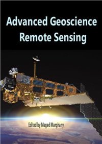
Ebook: Advanced Geoscience Remote Sensing
Author: Marghany M. (Ed.)
- Genre: Geology
- Tags: Науки о Земле, Дистанционное зондирование Земли
- Language: English
- pdf
AvE4EvA, 2014. IX, 271 p. — ISBN-10 9535115812, ISBN-13 978-9535115816.This volume is dedicated to microwave remote sensing applications, nuclear, geophysics and telecommunication; and environment remote sensing investigations.Nowadays advanced remote sensing technology plays tremendous roles in building a quantitative and comprehensive understanding of how the Earth system works. The advanced remote sensing technology is also used widely to monitor and survey the natural disasters and man-made pollution.
Besides, telecommunication is considered as an accuracy remote sensing advanced technology tool.
Precise usage of remote sensing and telecommunication cannot be built without comprehensive understanding of mathematics and physics.Contents
Preface
Mathematical Description of Bayesian Algorithm for Speckle Reduction in Synthetic Aperture Radar Data
Oil-Spill Pollution Remote Sensing by Synthetic Aperture Radar
Simulation of Tsunami Impact on Sea Surface Salinity along Banda Aceh Coastal Waters, Indonesia
HF Radar Network Design for Remote Sensing of the South China Sea
A Three-dimensional of Coastline Deformation using the Sorting Reliability Algorithm of ENVISAT Interferometric Synthetic Aperture Radar
On the Modification of Nuclear Chronometry in Astrophysics and in Geophysics
Exploring and Using the Magnetic Methods
Identification of Communication Channels for Remote Sensing Systems Using Volterra Model in Frequency Domain
Statistical Characterization of Bare Soil Surface Microrelief
Oil Spill Pollution Automatic Detection from MultiSAR Satellite Data Using Genetic Algorithm
Morphodynamic Environment in a Semiarid Mouth River Complex Choapa River, Chile
Download the book Advanced Geoscience Remote Sensing for free or read online
Continue reading on any device:

Last viewed books
Related books
{related-news}
Comments (0)