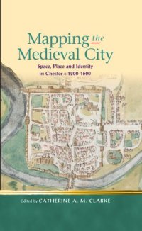
Ebook: Mapping the Medieval City: Space, Place and Identity in Chester c. 1200-1600
Author: Catherine A. M. Clarke
- Tags: England, Great Britain, Europe, History, Wales, Great Britain, Europe, History, Wales, Great Britain, Europe, Travel
- Series: Religion and Culture in the Middle Ages
- Year: 2012
- Publisher: University of Wales Press
- Language: English
- pdf
This fascinating volume brings together scholars from a wide range of disciplines, including literary studies, history, geography, and archaeology, to investigate questions of space, place, and identity in the medieval city. Using medieval Chester as a case study—with attention to its location on the border between England and Wales, its rich multilingual culture, and its surviving infrastructure—these contributions recover the experience of medieval city living and in doing so provide fresh perspectives and generate new questions about urban space both during this period and beyond.
Download the book Mapping the Medieval City: Space, Place and Identity in Chester c. 1200-1600 for free or read online
Continue reading on any device:

Last viewed books
Related books
{related-news}
Comments (0)